Tropical Depression 10 Getting Better Organized
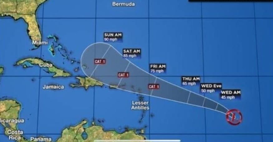
At 11 p.m., the center of the storm was about 1,030 miles east of the Leeward Islands. It was moving to the west-northwest at 10 mph with maximum sustained winds of 35 mph with higher gusts.
A west-north-westward motion at a somewhat faster forward speed is expected over the next few days. On the forecast track, the system will be near the northern Leeward Islands Thursday night or Friday. Strengthening is forecast during the next couple of days, and the depression is expected to become a tropical storm by Wednesday morning.
The system is forecast to become a hurricane by the time it moves near the northern Leeward Islands. When it does form into a tropical storm, it will be called Jerry.
The Disaster Committee of St. Eustatius is monitoring this system closely, and will continue to keep you informed.
Please continue to be prepared.
More News
-
 Bonaire
Temporary Closure of Bonaire Library Due to Relocation
-
 Bonaire
Students of the Royal Netherlands Marechaussee (KMar) Receive Diplomas
-
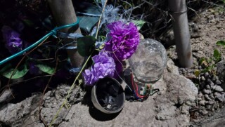 St. Eustatius
Memorial Wreath Vandalized on St. Eustatius
-
 Bonaire
Ride for the Roses 2025: Great Success with a Record Number of Participants
-
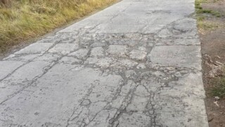 Geen categorie
Statia Government Responds to Infrastructure and Development Concerns
-
 Advertisement
IND application or guarantee?
-
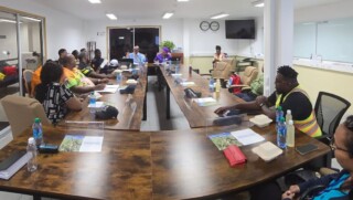 News
NewsDisaster Committee Statia Holds First Meeting in 2025
-
 News
NewsSeveral Fines Issues During Traffic Check Saba
More News
-
Bonaire
Temporary Closure of Bonaire Library Due to Relocation
-
Bonaire
Students of the Royal Netherlands Marechaussee (KMar) Receive Diplomas
-
St. Eustatius
Memorial Wreath Vandalized on St. Eustatius
-
Bonaire
Ride for the Roses 2025: Great Success with a Record Number of Participants
-
Geen categorie
Statia Government Responds to Infrastructure and Development Concerns
-
Advertisement
IND application or guarantee?
-
News
Disaster Committee Statia Holds First Meeting in 2025
-
News
Several Fines Issues During Traffic Check Saba