
Saba to finalize baseline vegetation survey
THE BOTTOM – The Public Entity Saba will finalize the baseline vegetation survey for its reforestation project. Last year, the survey was carried out twice using a drone and multispectral camera specialized in capturing vegetation on a detailed level.
The survey, however, was not completed due to technical challenges. The final part of the survey will be carried out Friday, February 2, and Saturday, February 3.
Several areas will be surveyed. The north to northwest part of the island will be surveyed. This falls mainly within the Mt. Scenery National Park from the Sulphur Mine to Well’s Bay area. The area surrounding the Fort Bay Road and the Black Rocks area will also be surveyed. These activities will be carried out in close coordination with the airport manager and public order and safety manager to ensure both air traffic and public safety.
The vegetation survey will serve as a starting point for monitoring the recovery and expansion of Saba’s native vegetation. It will also give a clear picture of the current status of vegetation density and health and soil erosion throughout the island. This information will be used to identify and map out areas for (re)foresting and other restoration and mitigation activities as part of the implementation plan for this project.
Reforestation
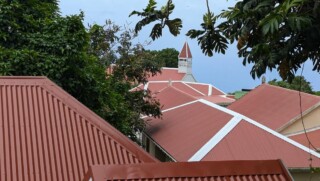
The reforestation project is being carried out as part of the Caribbean Netherlands Nature and Environment Policy Plan 2020 – 2030. The goal of this project is to boost the recovery process and expansion of the island’s forested areas in order to reduce the land-based pressures of erosion and runoff that impact Saba’s coral reefs and increase the availability of local food. The below image is a result of the first 2 surveys that were carried out last year.
Meer News
-
 Advertisement
Traveling abroad?
-
 Airlift
Curaçao Seeks ‘Level Playing Field’ for Local Airlines
-
 Events
First Edition of Bonaire by Night on Friday, August 2
-
 Bonaire
Edsel Winklaar appointed interim director at Selibon N.V.
-
 Airlift
Aruba speaks to Gol Airlines about Brazil market expansion
-
 Healthcare
1,500 healthcare professionals trained in acute care by Caribbean Health Academy
-
 St. Eustatius
Empowering Girls: Mega D Youth Foundation hosts inspiring session with Miss Mature Shomica Griffith
-
 Saba
SabaSaba executes climate change survey among residents
Meer News
-
Advertisement
Traveling abroad?
-
Airlift
Curaçao Seeks ‘Level Playing Field’ for Local Airlines
-
Events
First Edition of Bonaire by Night on Friday, August 2
-
Bonaire
Edsel Winklaar appointed interim director at Selibon N.V.
-
Airlift
Aruba speaks to Gol Airlines about Brazil market expansion
-
Healthcare
1,500 healthcare professionals trained in acute care by Caribbean Health Academy
-
St. Eustatius
Empowering Girls: Mega D Youth Foundation hosts inspiring session with Miss Mature Shomica Griffith
-
Saba
Saba executes climate change survey among residents