Satellite images used to Map Coralita Invasion St. Eustatius
ORANJESTAD- A recently published report highlights the ability of using satellite imagery to systematically map Coralita’s distribution over the island of St. Eustatius.
The approach could provide key insights into how habitat and vegetation are changing over time to aid in conservationists’ efforts to minimize the negative effects of Coralita and similar invasive species.
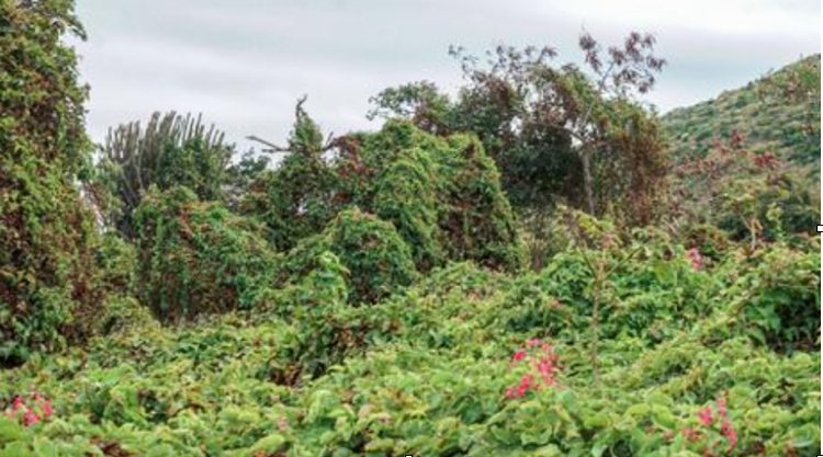
Coralita is a fast-growing, climbing vine with beautiful pink or white flowers. Originally from Mexico, Antigonon leptopus started out as a popular garden plant, but has expanded its territory and is now aggressively invading natural areas. Its fast-growing nature means it can outcompete most native species for terrain, quickly making it the dominant species, and reducing overall diversity.
This is especially the case on St. Eustatius, where ground surveys indicate the plant already appears on 15-33% of the island.
Monitoring
One of the biggest issues in controlling invasive species is accurately accounting for its presence, particularly if data needs to be collected over a wide area. This is where satellite imagery can help by providing an affordable, high spatial resolution option.
A new collaborative study from the Utrecht University, University of Zurich, Wageningen University, and the Technical University of Braunschweig provided key insight by using such satellite imagery to identify Coralita.
The method is successful, as areas dominated by Coralita emit a relatively distinct electromagnetic signal that can be detected by satellites. Once the distribution of Coralita has been mapped using this technique, it is possible to identify the environmental conditions associated with Coralita’s presence. This approach provides a relatively low-cost solution that is powerful, accurate and repeatable; key in identifying and monitoring its spread in the future.
Meer News
-
 Advertisement
Traveling abroad?
-
 Airlift
Curaçao Seeks ‘Level Playing Field’ for Local Airlines
-
 Events
First Edition of Bonaire by Night on Friday, August 2
-
 Bonaire
Edsel Winklaar appointed interim director at Selibon N.V.
-
 Airlift
Aruba speaks to Gol Airlines about Brazil market expansion
-
 Healthcare
1,500 healthcare professionals trained in acute care by Caribbean Health Academy
-
 St. Eustatius
Empowering Girls: Mega D Youth Foundation hosts inspiring session with Miss Mature Shomica Griffith
-
 Saba
SabaSaba executes climate change survey among residents
Meer News
-
Advertisement
Traveling abroad?
-
Airlift
Curaçao Seeks ‘Level Playing Field’ for Local Airlines
-
Events
First Edition of Bonaire by Night on Friday, August 2
-
Bonaire
Edsel Winklaar appointed interim director at Selibon N.V.
-
Airlift
Aruba speaks to Gol Airlines about Brazil market expansion
-
Healthcare
1,500 healthcare professionals trained in acute care by Caribbean Health Academy
-
St. Eustatius
Empowering Girls: Mega D Youth Foundation hosts inspiring session with Miss Mature Shomica Griffith
-
Saba
Saba executes climate change survey among residents