
Weather Saba & Sint Eustatius Tropical Cyclone Bulletin

Oranjestad, St. Eustatius, The Bottom, Saba – Tropical Cyclone Bulletin No. 1. Warning Message No. 1 Date: Tuesday July 28, 2020 Time: 12:23 local time. Tropical Storm warning in effect for potential tropical cyclone NINE. Heavy rain (3-6 inch, possibly upto 8 inch), with risk of flash floods will be the main concern. The system is expected to pass about 63 km SSW of Saba 18 AST and 59 km SSW of Statia 17 AST on Wed Jul 29. Still uncertainty about the track and intensity.
Next bulletin: 03:00 PM AST
Effect on local conditions
Winds:
From Tuesday evening strong easterly winds, force 6, are expected. On Wednesday near gale winds, force 7, possibly gale force 8 (39-46 mph, 62-74 km/h) in the evening with occasional gusts up to 50 kt (60 mph, 90 km/hr) are expected. Winds will gradually veer from NE to S by wednesday evening.
Caution: the system is still in the formative stage, greater than average uncertainty exists regarding both the short-term and longer-term track and intensity forecasts.
Seas:
Wednesday increasing wave heights. Wednesday evening highest waves are expected to be 10-12 ft. Thursday during the course of the day gradually decreasing to 5-8 ft.
Rainfall:
3-6 inches, loc 8 inches, potential threat for flash floods and mudslides.
Local authorities and residents of Saba and St. Eustatius are advised to continue monitoring the further progress of this weather system and to take all necessary measures to safeguard life and property.
Meer News
-
 Advertisement
Traveling abroad?
-
 Airlift
Curaçao Seeks ‘Level Playing Field’ for Local Airlines
-
 Events
First Edition of Bonaire by Night on Friday, August 2
-
 Bonaire
Edsel Winklaar appointed interim director at Selibon N.V.
-
 Airlift
Aruba speaks to Gol Airlines about Brazil market expansion
-
 Healthcare
1,500 healthcare professionals trained in acute care by Caribbean Health Academy
-
 St. Eustatius
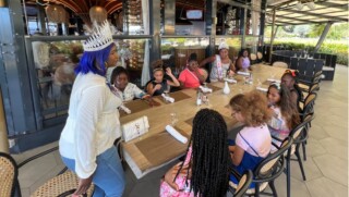
Empowering Girls: Mega D Youth Foundation hosts inspiring session with Miss Mature Shomica Griffith
-
 Saba
SabaSaba executes climate change survey among residents
Meer News
-
Advertisement
Traveling abroad?
-
Airlift
Curaçao Seeks ‘Level Playing Field’ for Local Airlines
-
Events
First Edition of Bonaire by Night on Friday, August 2
-
Bonaire
Edsel Winklaar appointed interim director at Selibon N.V.
-
Airlift
Aruba speaks to Gol Airlines about Brazil market expansion
-
Healthcare
1,500 healthcare professionals trained in acute care by Caribbean Health Academy
-
St. Eustatius
Empowering Girls: Mega D Youth Foundation hosts inspiring session with Miss Mature Shomica Griffith
-
Saba
Saba executes climate change survey among residents